

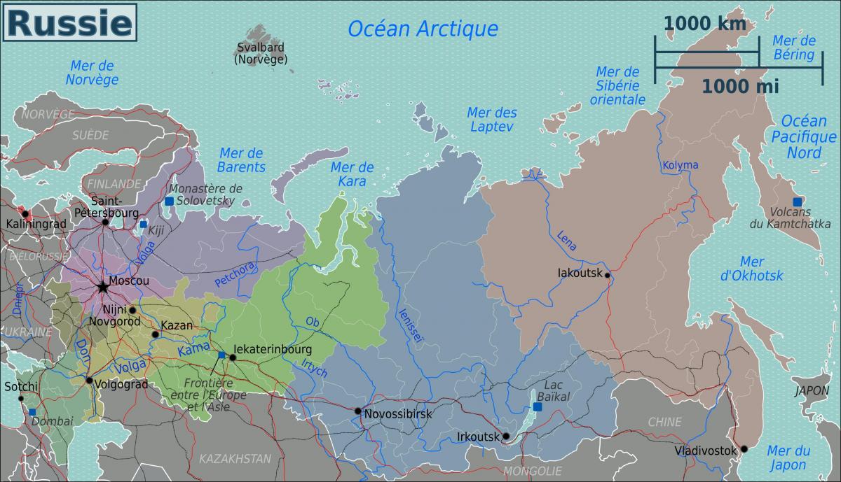
You can find on this page the Russia region map to print and to download in PDF. The Russia political map presents states, regions, provinces and surrounding areas of Russia in Europe.
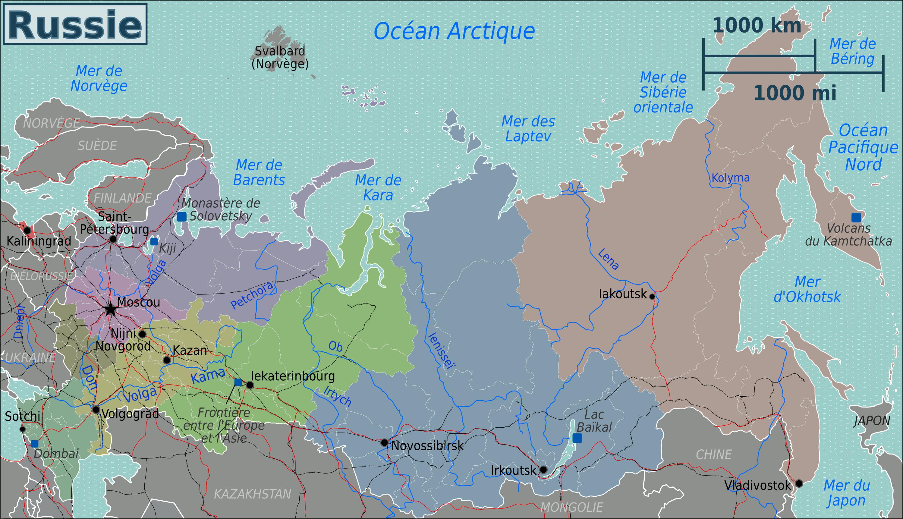
The Russia regions map shows surrounding areas and provinces of Russia. This administrative map of Russia will allow you to know regions of Russia in Europe. The Russia regions map is downloadable in PDF, printable and free.
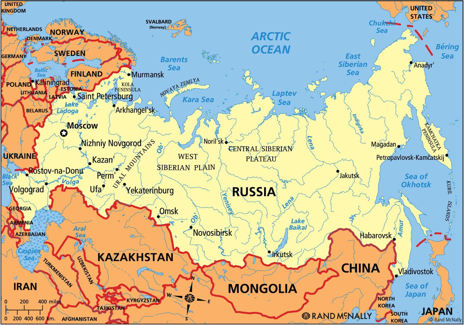
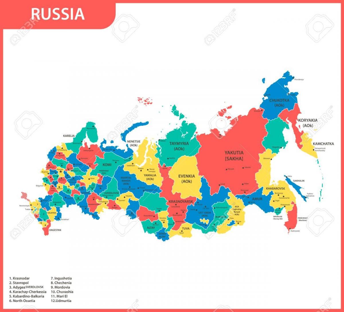
Administratively, the Federation has generally relied on regional divisions inherited from the Stalin and Brezhnev constitutions of 1936 and 1977. Each area with a predominantly Russian population is constituted as a territory (kray) or region (oblast); some non-Russian nationalities are constituted, in descending order of importance, as republics, autonomous regions (oblasts), and autonomous areas (okrugs). 47 Russian regions as its mentioned in Russia regions map (oblasts; the cities of Moscow and St. Petersburg also have oblast status); and eight Russian territories (krays). Oblasts and krays are roughly equivalent to provinces. In addition to Moscow, other major urban areas in Russia include Saint Petersburg (formerly Leningrad), Nizhny Novgorod (formerly Gorky), Rostov-na-Donu, Volgograd, Kazan, Samara (formerly Kuybyshev), Ufa, Perm, Yekaterinburg (formerly Sverdlovsk), Omsk, Chelyabinsk, Novosibirsk, and Vladivostok.
The 46 oblasts (regions) of Russia is the most common type of federal subjects, with federally appointed governor and locally elected legislature. The 1 autonomous oblast as you can see in Russia regions map (the Jewish Autonomous Oblast), historically, autonomous oblasts were administrative units subordinated to krais. In 1990, all of them except for the Jewish AO were elevated in status to that of a republic.
In 1992, the Russian regions signed the Federation Treaty, establishing and regulating the current inner composition of Russia, based on division of authorities and powers among Russian government bodies and government bodies of constituent entities (see Russia regions map). The Federation Treaty was included in the text of the 1978 Constitution of the RSFSR (Russian Soviet Federative Socialist Republic). In 1993, when the current Constitution of Russia was adopted, there were 89 federal subjects listed. By 2008, the number of federal subjects had been decreased to 83 because of several mergers. In 2014, Sevastopol and the Republic of Crimea became the 84th and 85th federal subjects of Russia.
The Russia political map shows regions and provinces of Russia. This administrative map of Russia will allow you to show regions, administrative borders and cities of Russia in Europe. The Russia political map is downloadable in PDF, printable and free.
The politics of Russia (the Russian Federation) takes place in the framework of a federal semi-presidential republic as its shown in Russia political map. According to the Constitution of Russia, the President of Russia is head of state, and of a multi-party system with executive power exercised by the government, headed by the Prime Minister, who is appointed by the President with the parliament approval. Legislative power is vested in the two chambers of the Federal Assembly of the Russian Federation, while the President and the government issue numerous legally binding by-laws.
Russia has faced serious challenges in its efforts to forge a political system to follow nearly seventy-five years of Soviet rule. For instance, leading figures in the legislative and executive branches have put forth opposing views of Russia political direction and the governmental instruments that should be used to follow it. With a new constitution and a new parliament representing diverse parties and factions, Russia political structure subsequently showed signs of stabilization as its mentioned in Russia political map. As the transition period extended into the mid-1990s, the power of the national government continued to wane as Russia's regions gained political and economic concessions from Moscow.
Presently there are four political parties that make up the State Duma (parliament) as you can see in Russia political map. In addition there are many minor ones. The struggle between executive and legislative branches was partially resolved by the new constitution, the two branches continued to represent fundamentally opposing visions of Russia future. Most of the time, the executive was the center of reform, and the lower house of the parliament, State Duma, was a bastion of anti-reform communists and nationalists.

The Russia states map shows all departments and regions of Russia. States map of Russia will allow you to know areas and cities of Russia in Russia. The Russia states map is downloadable in PDF, printable and free.
Russia has 9 krais or krays (states) as its mentioned in Russia states map, they are essentially the same as oblasts. The "territory" of Russia designation is historic, originally given to frontier regions and later also to the administrative divisions that comprised autonomous okrugs or autonomous oblasts.
Nowadays difference between krai (state) and oblast is practically non-existent, but these names are still kept due to purely historical reasons. Oblasts and krays are roughly equivalent to states as you can see in Russia states map. The Russian Empire at various times included the subdivisions known as krais. Some of these krais were: Caucasus Krai, Northwestern Krai, Southwestern Krai, Turkestan Krai, Privislinsky Krai, Uriankhaisky Krai.
“Krai” (state) in Russian Empire was a name for remote, sparcely populated, but large territory. Due to obvious administrative complications, population of krais usually lived under specifically regulated status, some krais were turned(divided) into smaller gubernias after some time as its shown in Russia states map. During USSR times, krai was different from oblast basically with one thing: krais could include subdivisions: autonomous okrugs and autonomous oblasts.